Cape Hatteras Lighthouse Commemorative Survey Disks
The North Carolina Geodetic Survey (NCGS) will commemorate the move of the Cape Hatteras Lighthouse by installing four commemorative survey disks inscribed with an inspiring scene of the lighthouse which was designed by Mr. John David Hardee of the North Carolina Department of Environment and Natural Resources (DENR), Public Affairs Department. These survey disks, which are also referred to as 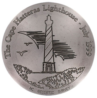 monuments, stations, and markers, are brass disks 4 inches in diameter. They mark a position on the earth’s surface with a known geographic location and can be utilized by land surveyors conducting surveys in the area.
The geographic position of the relocated lighthouse was determined by land surveys conducted by NCGS and the private surveying firm, Seaboard Surveying and Planning, Inc. NCGS will install one survey disk at an eccentric point on the catwalk at the top of the light house and three survey disks around the base of the lighthouse. The geographic position of each disk will then be integrated within the National Spatial Reference System (NSRS).
The reason why NCGS will be installing commemorative survey disks instead of installing just standard issue survey disks for these two positions is because the move of this lighthouse was a phenomenon followed by the nation in news broadcasts, newspapers, and magazines. But, why was the move followed? Perhaps the answer can be found in the history of Cape Hatteras and the lighthouse itself.
The Cape Hatteras Lighthouse is the tallest masonry lighthouse in the United States and is located on the Outer Banks of North Carolina. It was built in 1870 to serve as a navigational bearing to mariners as they navigated the Outer Bank’s coastline, which is also known as the “Graveyard of the Atlantic”, and in particular for those sailors to avoid the nearby, treacherous Diamond Shoals. This coastline earned its morbid name from the estimated 2200 shipwrecks that have occurred there since European exploration. In contrast, the guiding light from this lighthouse was a major turning point for coastal trade on the Atlantic coast. The United States has officially recognized this lighthouse as an historic landmark in the National Register of Historic Places.
The Cape Hatteras lighthouse was not the first lighthouse built at Cape Hatteras. The first lighthouse was located 1 mile inland and was built in 1803 with sandstone block to a height of 90 feet. Unfortunately, it was poorly constructed. Furthermore, it was too short and its Argand-type reflector lamps were too dim to be effective. Consequently, the lighthouse light was replaced with the more powerful, Lewis-type reflector lights, but the structure was still too short and still had structural problems. In 1854, this poorly constructed lighthouse was actually extended 60 more feet in height and a Fresnel lens was installed. Unfortunately, this earlier lighthouse was shelled during the Civil War, which further weakened the structure. After the War it was judged to need replacement and construction for the present day lighthouse began in 1868. After the second lighthouse was activated in 1870, the first lighthouse was razed in 1871. Interestingly, the ruins of the first lighthouse remained until a storm in 1980 swept them away.
The present day lighthouse was built to a height of 208 feet and was located 1500 feet from the ocean in 1870. As years passed, the ocean encroached westward to such an extent that in 1935 the waves were breaking just 100 feet of the lighthouse. Since the 1930’s, the following extensive measures have been attempted to protect the lighthouse from the encroaching ocean; installing steel groins along the shoreline, constructing a barrier sand-dune system along the entire length of the island, enriching the beach with sand pumped from the Pamlico Sound and from Cape Hatteras Point, and installing sandbags.
Despite all these efforts to protect the lighthouse, the ocean came within 50 feet in 1980. Consequently, it became obvious that the lighthouse was in danger of being destroyed by the encroaching ocean. In 1981, the “Save the Cape Hatteras Lighthouse Committee” was created and sponsored a public workshop in 1982 to outline both short-term and long-term protection plans for the lighthouse. Unfortunately, the long-term protection plans that were presented were mutually exclusive. One option was to build a seawall that would encircle the lighthouse. The other option was to move the lighthouse inland. At the time, neither option had overwhelming support. Consequently, the following short-term measures were tried: installing sandbags and “Seascape”, extending the lighthouse’s closest groin by 150 feet, and ‘planting’ artificial seaweed in the tidewaters near the lighthouse.
In 1987, the long-term option of moving the lighthouse was further promoted when the private organization, “Move the Lighthouse Committee”, provided the National Park Service with information on technology that could be used to move the lighthouse inland. Yet, the debate over the best method to protect the lighthouse continued until 1998 when the International Chimney Corporation (ICC) of Buffalo, New York was awarded a design-build contract including a geotechnical and material investigation at the lighthouse.
After nearly 70 years of efforts to protect the lighthouse in its original location, the relocation process went quickly. In January of 1999, ICC began the construction process of preparing the lighthouse for the move. Six months later on June 17, ICC began moving the lighthouse to its new location, 2900 feet from the original location. The move took 23 days and the lighthouse arrived at its new location on July 9, 1999. It was then reopened to the public on May 26, 2000.
Originally published in the Berntsen SurveyLog Volume 11, No. 3 (September, 2000)