Surveyors Scale Slopes of Summit
Benchmark Set on Mighty Mount McKinley
In June of 1989, a team of eight men ─ formally called The 1989 Mt. McKinley Global Positioning Expedition ─ set out from a base camp to perform one of the most unusual survey projects the world has ever seen. Their mission was to verify, by the most sophisticated satellite positioning methods, the true summit elevation and position of the highest mountain peak on the North American continent, Mount McKinley. The project involved hundreds of hours of planning, thousands of dollars in costs, the use of the most up to date global positioning equipment to track several special military communication satellites orbiting the earth . . . and one Berntsen Survey Monument, which was placed precisely at the summit.
 Mount McKinley is located in a remote and beautifully primitive national park. The vast (by any standards) Denali National Park covers more than 9,375 square miles and is located 240 miles north of Anchorage and 120 miles south of Fairbanks. In addition to Mt. McKinley, whose elevation was estimated by best efforts prior to the climb to be 20,320 feet, the park also encompasses Mounts Foraker (17,400 feet), Silverthrone (13,220 feet), and Russell (11,670 feet).
The mountains are part of the Alaska Range which stretches 600 miles across the lower third of Alaska. The mountain and range above which it towers are a part of the magnificent system of mountains called the Cordilleran system, which extends from South America north through the United States, through Canada, into Alaska, past McKinley, and then to the Aleutian Islands. It is an area filled with geologic interest and activity.
The Alaska Range is also a natural barrier between the coastal lowlands around Anchorage and the northern interior. The western side of the range forms a drainage divide where rivers flow west to the Bering Sea or south to the Gulf of Alaska. The divide is generally about 7,000 feet to 9,000 feet in elevation or less than half of McKinley’s tremendous height making the mountains really stand out in chilling isolation.
The range is actually a long band of geologic turmoil that lies at the interface of two crustal plates. The Denali Fault system, which is the largest crustal break in North America, stretches 1,300 miles across Alaska’s full width. Geologists now know that sections of the earth are not stationary but are in fact quite mobile. The drifting movements account for most of the geologic changes that occur in the earth’s surface. When plates separate, continents drift apart and ocean floors open up. When plates touch and move against each other, plate edges can alter dramatically. The effect is called orogeny and the result is bent and folded rock layers and mountains.
In the case of McKinley, this geologic force produced a rise from Wonder Lake in the 2,000 foot lowland on the north to the 20,320 foot summit, the highest and most spectacular rise in vertical elevation of any mountain anywhere on earth, including any mountain in the Alps or Himalayas.
The mountain was probably discovered shortly after the first people crossed the Bering Land Bridge centuries ago. Mount McKinley is without question, the most spectacular and impressive single feature of the entire Alaskan landscape. McKinley’s size and grandeur was not missed by the early native inhabitants of Alaska. To them it was Denali, Traleyka, or Doleyka (“the high one” or “the great one”), according to which Athabaskan tribe they belonged to. The companion mountain to the west, Mount Foraker, was “Denali’s Wife”. For these first Alaskans, the mountain was the home of the sun, as this was the point where the midsummer sun also set, flooding the mountain’s huge north wall with a spectacular red and crimson light show. Many legends of great spiritual significance centered around the mountain and played an important part in their lives.
The earliest European to sight and document his observations of the mountain was an Englishmen, Captain George Vancouver, who explored Cook Inlet in 1794. He caught but a glimpse of the “distant stupendous mountains”. The first map to show the mountain is from the pen of Baron Ferdinand P. van Wrangell, an admiral of the Russian navy, and governor of the Russian American Company, when Alaska was under the ownership of Russia. His 1839 map points out the location of what is now known as Mount McKinley (Tenada on his map) and Mount Foraker (Tschigmit).
When “Seward’s Folly” or the “Icebox” now known as Alaska was purchased from Russia in 1867 for the remarkable sum of $7,200,000 and the simple flag raising took place on October 18, 1867 at Castle Hill in the old Russian town of Sitka, the area had not even been explored. It took the discovery of gold in the late 1800s to bring people to Alaska and start exploration.
Many ambitious men made the journey to Alaska including William A. Dickey, one of the 2,000 or so gold seekers who landed at Cook Inlet in 1896. He sent home glowing reports of the beauty of the region and the mighty mountain he had seen. An account of his adventures appeared in the January 24, 1897 issue of the New York Sun telling of a mountain that rivaled Mt. Everest ─ Mount McKinley (which Dickey had named after his favorite and recently nominated presidential candidate from Ohio, William McKinley). Dickey explained later that, even though the native Alaskans called the mountain Denali, his name was as good as any. In fact, it was a retaliation against two strongly opinionated gold miners who, during a boat trip, had argued long and loud against the gold standard, which McKinley (and Dickey) favored. The name is now firmly rooted, regardless of how it originated and, like many of the colossal legends surrounding the State of Alaska and its mighty mountain, is perhaps the most “colossal” last word ending to any argument in modern history.
Official government exploration of the mountain began in 1898 when George Eldridge, of the United States Geological Survey, and his group of eight men departed from Cook Inlet. They traveled by boat upriver and then overland to the foothills of the Alaska Range. With the available equipment of the day, they determined McKinley’s elevation to be an amazingly accurate 20,464 feet. This is a glowing tribute to the care and skill of some of the early survey parties, who added so much to the knowledge and importance to the general public of land surveying. The following year Lieutenant Joseph Herron of the United States Cavalry was ordered to locate an overland route from Cook Inlet to the upper Yukon and Klondike gold fields. Geographic features such as Herron and Peters glaciers received their names from members of his party. Mount Foraker was named by this party after an Ohio senator.
In 1902, another U.S. Geological Survey expedition was to explore the mountain. This party was led by Alfred H. Brooks. They followed Herron’s trail to the north side of the range and then turned east to the foot of the north wall of the mountain. Brooks became the first man to record climbing the slopes of the continents highest mountain to a height of 7,500 feet. Most important, however are Brooks’ wonderful records and notes, detailing with great accuracy his geologic and geographical observations. His records were used for decades as the very best available in the area.
The physical challenge of the mountain is astounding. Between 1903 and 1913, there were no fewer than eight attempts to climb to the summit. The weather is some of the harshest found anywhere on earth. A minimum recording thermometer left on McKinley at the 14,500 foot level by the first successful expedition to reach the summit (Karstens’ Expedition) in 1913 and found undisturbed nineteen years later, registered an incredible temperature of ninety-five degrees below zero! (Harry Karstens, a man who knew the territory around McKinley well, later become the first superintendent of Mount McKinley National Park). Most of the year, the mountain is covered by ice and snow. Clouds hide the summit about 75% of the time in summer, and 60% of the time the rest of the year. Strong turbulence is common and wind gusts to over 150 miles per hour often occur during storms. The extreme, low air pressures and temperatures of the upper slopes have devastating effects on the human body including dehydration, headaches, loss of appetite and strength. Actually being the first climb to the summit was quite an accomplishment and the Karstens’ Expedition will always command respect from mountain climbers the world over for their magnificent effort.
Climbers today still face the same mighty challenge. With equipment fashioned from the finest modern alloys lightweight aluminum, and other materials like nylon, (instead of hand-made equipment of wood, canvas, and fur) the climb is certainly safer. Vacuum-dried food also made the journey somewhat more pleasant (although an early party in 1909 did claim to climb to the summit on a bag of doughnuts and a thermos of hot chocolate but actually reached the summit of North Peak, 850 feet lower and two miles north of South Peak, the true summit.)
Over 1,500 people from all parts of the world have now stood at the summit. Most start at the 7,500 foot level and reach that point by ski plane or helicopter. Accidents and illness do happen, and helicopters have rescued sick and injured from the mountain in situations which would have meant certain death only thirty years ago.
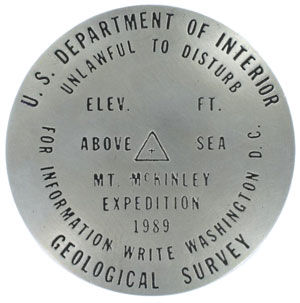
The weather in 1989 was favorable, and on June 18th, the summit was reached. Several feet of ice were penetrated with a special tool supplied by Berntsen for the event, and a super-alloy survey marker and stainless steel rod was left at the true summit, preserving the future climbers to see the efforts made in 1989 to add to man’s knowledge of the amazing world we live in.
As an interesting side note, one of the climbers took a spectacular short-cut down the mountain . . . he had packed along a parasail (part parachute ─ part glider/airplane), and added another colossal first to the many “firsts” surrounding this mountain. With a short run and mighty yell, he jumped over the edge near the summit for a spectacular soaring and sailing flight down the mountain slopes that would surely have thrilled and amazed the early climbers of McKinley who, like the other members of the 1989 party and parties who had gone before, had to merely climb down the highest mountain on the continent (not an easy task to say the least).
Oh, by the way…the true elevation of Mount McKinley as determined by the latest in survey equipment is 20,320 feet.
Originally published in the Berntsen SurveyLog Volume 1, No. 1 (February, 1990)